SAEDNEWS: Aq Qala in northern Golestan Province is known for its historic sites, fascinating mud volcanoes, and traditional Turkmen handicrafts. Discover the highlights of this captivating region.
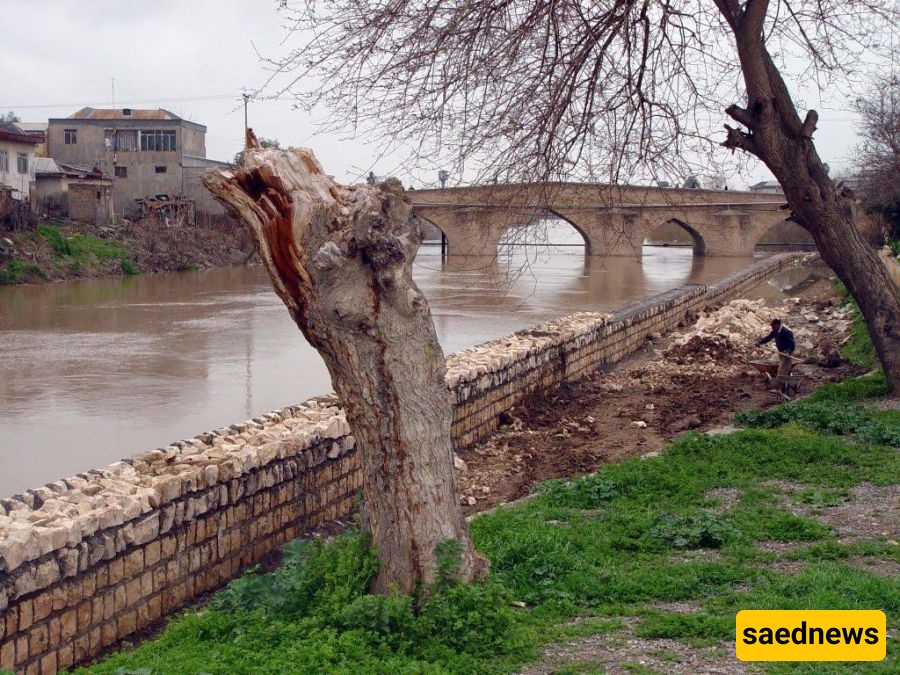
According to Saednews, Aqqala County is located in the northern part of Golestan Province, along the Gorganrud River. With its historical monuments, fascinating mud volcanoes, and traditional handicrafts such as Turkmen carpets and cushions, the county is one of the province’s notable tourist destinations.
With a population of approximately 109,000, Aqqala covers an area of about 1,763 square kilometers, accounting for approximately 6.8 percent of the province’s total area. A significant portion of its population consists of Turkmen communities.
The county borders Turkmenistan to the north, Gorgan and Aliabad County to the south, Gonbad-e Kavus County to the east, and Torkaman County to the west.
Around 964 AH, approximately 450 years ago, Shah Tahmasp I of the Safavid dynasty ordered the construction of a fortress known as Mubarakabad at the site of present-day Aqqala.
The defensive walls of the fortress extended for approximately 20 kilometers to the north, 2 kilometers to the west, and 1.6 kilometers to the east. The fortress covered an area of roughly 3.5 square kilometers.
After the reign of Shah Tahmasp, the fortress fell into ruins. However, Shah Abbas later ordered it to be repaired and rebuilt.
The name Aqqala, or Aq Qala, was probably adopted later. One explanation connects the name with the settlement of Turkic Qajar groups in the area, while another associates it with the Turkmen communities who settled there after the Qajars.
Some of the most significant events in Aqqala, historically known as Mubarakabad, took place after the reign of Shah Abbas, particularly during the era of Fath-Ali Khan Qajar and later under his son Mohammad Hasan Khan and grandson Agha Mohammad Khan Qajar, the founder of the Qajar dynasty.
Whenever they faced military setbacks or political difficulties, they often sought refuge in the northern regions around Aqqala and among the Turkmen tribes. They also used the region to mobilize forces and obtain military supplies.
Fath-Ali Khan spent part of his youth living in Aqqala.
From this region, Fath-Ali Khan was able to gain prominence after conquering Astarabad, Mazandaran, and several other areas. During the Afghan invasion of Iran and the siege of Isfahan under Shah Sultan Husayn Safavid, he became known as an influential commander in the north, particularly in Astarabad. His reputation eventually spread throughout the frightened capital.
For this reason, Tahmasp III, the crown prince, traveled to Mazandaran and then Astarabad after escaping Isfahan during the Afghan siege, seeking to benefit from Fath-Ali Khan’s power and influence.
Fath-Ali Khan also took him to Aqqala. This journey was probably intended to establish contact with the Turkmen tribes around Aqqala and seek the assistance of their armed horsemen against the invading Afghans.
After Fath-Ali Khan was killed, his son Mohammad Hasan Khan Qajar, the father of Agha Mohammad Khan, spent years resisting the forces and commanders of Nader Shah Afshar and the Zand dynasty in the Turkmen Sahra region and around Aqqala, with the support of local Turkmen tribes.
Watson identified Aqqala as the original center from which Mohammad Hasan Khan began to build his power.
After Mohammad Hasan Khan, his son Agha Mohammad Khan also maintained connections with the Turkmen tribes of the region during the early stages of his rise to power in Astarabad. Whenever he suffered setbacks, he occasionally sought refuge among the Turkmen.
However, approximately two decades later, after reaching the height of his power, circumstances changed and he was forced to suppress the Turkmen tribes who had once supported him.
One of Aqqala’s natural attractions is Incheh Wetland, located approximately 23 kilometers north of Aqqala.
The Incheh Mud Volcano lies on the western side of the wetland and is a major tourist attraction. The wetland provides a habitat for various migratory birds, including flamingos, swans, geese, herons, and other species.
Fish found in these wetlands include koli, orange, simparak, and glassfish. According to the regulations issued by the Gonbad Department of Environmental Protection, the fishing season runs annually from May 5 to March 5.
The network of wetlands and marshes offers access routes, camping areas, open landscapes, extensive meadows, and opportunities to observe both native and migratory birds. Its potential therapeutic uses and natural features also make the area highly suitable for the development of a major tourism center.
Voshmgir Dam was constructed approximately 62 kilometers northeast of Gorgan, at a location known as Sangar Savar, on the Gorgan River.
The dam is approximately 70 kilometers from the Caspian Sea and 24 kilometers from the Iran–Turkmenistan border.
The reservoir system includes a main reservoir with an original designed capacity of 60 million cubic meters and three additional storage reservoirs. The first, with a capacity of 18 million cubic meters, was constructed at the same time as the dam. The second, with a capacity of 12 million cubic meters, was completed in 1984, while the third has a capacity of 6 million cubic meters.
The dam was originally built to regulate and distribute approximately 325 million cubic meters of agricultural water annually for the irrigation of around 25,000 hectares of cultivated land.
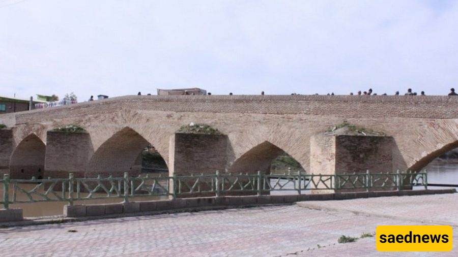
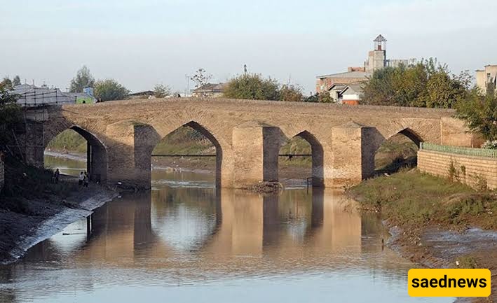
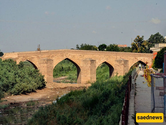
Another important attraction in the region is the historic Aqqala Bridge, located approximately 18 kilometers north of Gorgan. The bridge dates back to the Safavid period and has undergone several repairs and restoration projects in more recent times. It continues to be used today.
The bridge features beautiful brickwork and is regarded as one of the distinctive historical structures of the Gorgan region.
Its unique and carefully designed architectural style is one of the defining characteristics of Aqqala Bridge. Its construction began during a flourishing period of brickwork and brick architecture in Iran.
The bridge’s historical and cultural significance has contributed to its recognition as one of the country’s important tourist attractions.
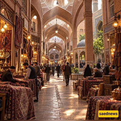
One of the popular attractions of Aqqala is its Thursday Market. In this lively local market, people from different communities and occupations offer a wide variety of goods.
Among the most attractive products are traditional Turkmen handicrafts, including carpets, rugs, and beautifully decorated cushions.
The market provides visitors with an opportunity to experience local commerce and become familiar with the traditional crafts and culture of the Turkmen people.
The ancient Qarn Yaraq Mud Volcano, located northwest of Aqqala, is another notable natural attraction in the county.
Qarn Yaraq is an old and heavily eroded geological and volcanic phenomenon. In the past, its crater released mud accompanied by gases instead of molten material and lava.
Today, the mud volcano appears as a cone-shaped hill, with the effects of erosion clearly visible across its surface. The gases responsible for the mud-volcano activity are believed to originate from underground oil and gas traps. Because the mechanism of mud volcanoes resembles certain aspects of volcanic eruptions, they are commonly referred to as “mud volcanoes.”
Various sources have recorded the diameter of its crater as ranging from approximately 500 to 700 meters.
“Qarn Yaraq” is a Turkmen expression meaning “split belly” or “a place where the belly of the earth has been split open.”