Think you know Iran? West Azerbaijan’s dreamy lakes, floating meadows and cliffside waterfalls will prove you don’t.
Welcome to Azerbaijan — the land of kindness, hospitality and the Azeri people. From roaring waterfalls to flowing rivers and lush greenery, the region’s nature offers a soul-soothing gift to visitors who come to explore Azerbaijan.
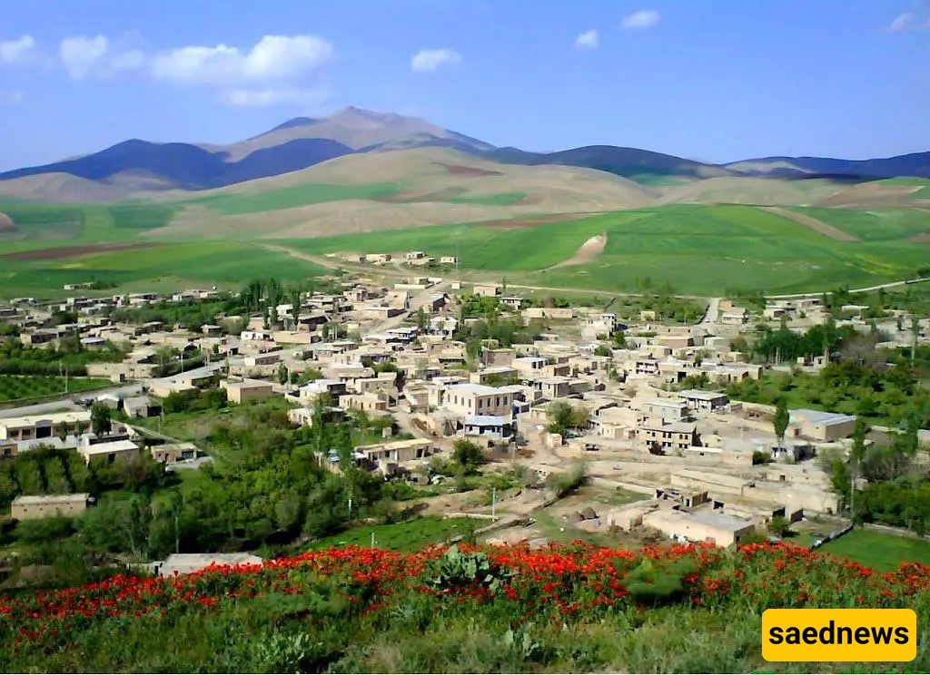
Despite its many natural and historical attractions and hospitable people, West Azerbaijan — centred on Urmia — has not yet secured the recognition it deserves as a tourism destination. In this post we introduce the region’s most notable natural sights across cities such as Urmia, Sardasht, Takab and Mahabad, so you can add this region to your travel list for spring and summer.
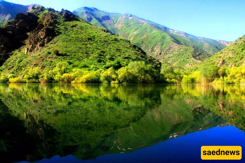
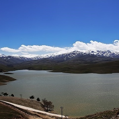
If you want to see pristine nature, try fishing, and interact closely with Azerbaijan’s nomads and tribes, visit the beautiful Marmisho Lake. This lake lies 45 km west of Urmia on the Iran–Turkey border and is a paradise for nature lovers. Passing along the Nazlu Chay riverbank you will see the villages Pashan, Bani and Helani en route, finally arriving at the green village of Marmisho — a journey that is itself part of the destination’s charm. The Nazlu Chay river pours into a very green and scenic gorge, forming Marmisho Lake — now home to many aquatic species and plants.
Spring and summer are the best seasons to visit this majestic area. In spring you are likely to meet local beekeepers who bring their bees to the wildflower meadows here, and you can taste genuine natural honey. Another memorable experience is meeting the nomads and tribes who camp in the area. Once you’ve experienced their hospitality and warmth, greet them and accept an invitation to sit for a cup of tea brewed over an open fire.
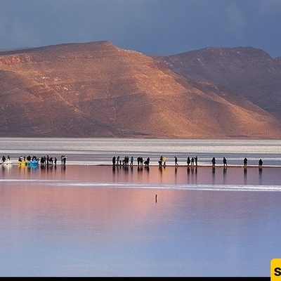
When we hear “Lake Urmia” these days, concern about drying and loss often follows — yet the lake, Iran’s largest inland lake and the world’s second-largest salt lake, still retains its beauty and attracts visitors. Lake Urmia divides Azerbaijan into western and eastern parts and has a total of 102 islands. Its diverse plant life, remarkable wildlife and beaches are more than enough reason to plan a trip to Azerbaijan. Besides swimming and boating and watching rare sunsets, many people come to Lake Urmia for therapeutic purposes (mud therapy). In summer, when less freshwater flows into the lake and algal and bacterial activity intensifies, the lake’s colour can shift from blue and green to red — creating an extraordinary spectacle.
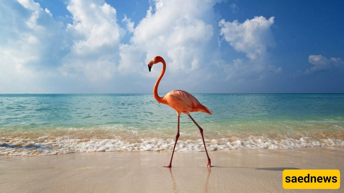
One of Lake Urmia’s best-known islands is Ashk Island, located within Urmia National Park; visiting requires a permit from the Department of Environment. Ashk Island lies south of Kaboudan and 40 km from Bandar Golmanxaneh, and hosts native and migratory birds such as flamingos and tingeh (a local waterbird). The island was chosen as a site for reintroducing the Persian yellow deer; because the island does not retain water naturally (due to the lake’s carbonate structure and the island’s low elevation), piped water and artificial watering points have been installed.
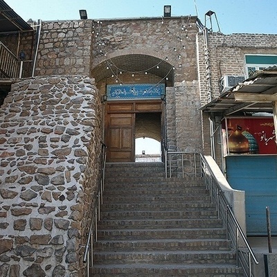
You haven’t really seen Urmia until you stroll the Band promenade and sample corn, dondurma (ice cream), kebab, tea and hookah there. The Band is the city’s main hangout — people flock there throughout the week, especially on Thursdays and Fridays, to spend time in this beautiful area. It lies 5 km from Urmia along Shahid Beheshti (Daneshkadeh) Street. Along both sides of the Band road you’ll find teahouses, kebab shops and ice-cream parlours. The grand, luxurious buildings along the promenade will catch your eye as you pass.
Silvana (Silvaneh), meaning “a piece of paradise,” is one of the 19 areas in the world identified as having pure oxygen. The region’s lakes and springs are fed by the natural melting of highland snow. Silvana lies 30 km west of Urmia on the border heights between Iran and Turkey. It’s no surprise that one of Iran’s most natural honeys is produced from the tulip meadows and flower fields of this area.
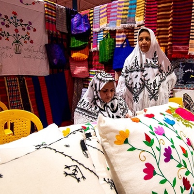
On a trip to this highland you can enjoy natural honey and local dairy products, and buy souvenirs such as carpets and kilims, traditional woven cloth (jajim) and locally made wool hats and socks.
Sahulan Cave is located 35 km from Mahabad on the Mahabad–Bukan road; it was first studied about a century ago by the French researcher Jacques de Morgan. Experts say the cave is some 70 million years old. The cave consists of several large basins linked by water-filled passages; the only creatures living within are rock doves and bats. By rowing in small boats you can explore different parts of the cave, see the limestone stalactites and stalagmites, and watch doves fly across sections of the ceiling. You can drive up to the cave entrance to visit it.
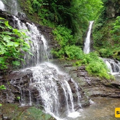
Spring and summer are the best seasons to enjoy Kurdistan’s nature. Kurdistan’s roads, with high mountains and meadows covered in chamomile and poppies, rank among Iran’s most beautiful routes. In spring, as snow melts at higher elevations, many small and large waterfalls flow on the way to Sardasht and the oak forests begin to green. Along this route, locals place bottles of doogh (a yogurt drink) for sale under the waterfall, and their ashe-doogh (a soup made with doogh) is prepared over open fires and ready to eat. You simply must treat yourself to a bowl of ashe-doogh and the delicious local snack called kolāneh. Kolāneh is a Kurdish local snack made by placing special local herbs inside a dough, baking it like flatbread in a tandir oven, and then rolling it in hot local butter and oil before serving. At the destination awaits the beautiful and powerful Shelmash Waterfall, some 50 metres high.
Salmas is located 15 km south of Sardasht. If you head from Sardasht on the mountain road toward the villages Maraghan and Shelmash, before reaching Shelmash village you will see the three-tiered Shelmash waterfall. It’s worth descending all the steps of this three-tiered waterfall to reach its base. After viewing the falls, enjoy a local solṭāni kebab with local doogh in the surrounding oak forests.
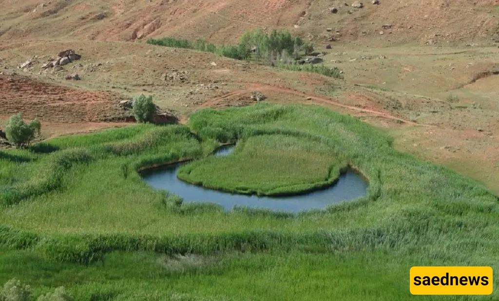
Chamli’s floating grass is an island covered with reeds that floats on a pond of unknown depth. This island is formed by the joining of reed roots and moves across the water without any connection to the shore. This mat of vegetation — up to 100 square metres in size — shifts position on the pond; for example, if you visit at the start of the month you may be able to step onto it, but if you return 10–15 days later the reed mat may have moved toward the deeper reed zone (where reeds grow up to two metres) and access may no longer be possible. The exact cause of Chamli’s buoyancy is unclear, but some experts attribute it to ground movement, wind, or air currents. Chamli’s floating grass (locally called “Chamli Goli”) is located 15 km from the historic town of Takab (West Azerbaijan Province), on the route to the village Yolqun Aghaj.
If you enjoyed this guide or have personal tips about West Azerbaijan’s nature spots, share your experiences — it helps other travellers plan unforgettable trips.