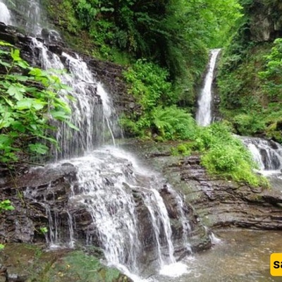
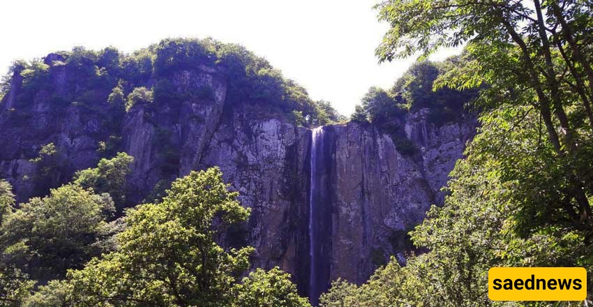
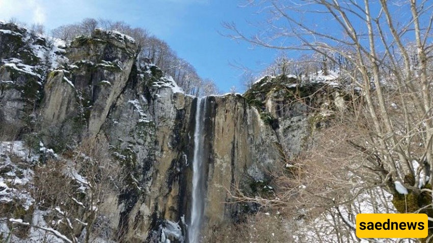
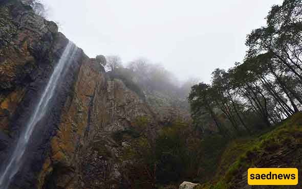
Laton Waterfall, near Astara in Gilan province, combines towering cascade, ancient Hirkani forest, highland meadows and mountain routes into a single day-trip-worthy destination. Fed from Mount Spinas, Laton — at about 105 metres — is commonly described as Iran’s tallest waterfall and offers two main approaches
Good mountain-hiking routes that also reach interesting destinations are not rare in Iran. From peaks to highland pastures and tall waterfalls you can find many spots, but few places combine as many attractions as Laton Waterfall in Gilan.
In this article from SaedNews Travel Magazine we introduce Laton Waterfall — which also represents a scenic forest, mountain lakes, pristine highland pastures, a river and rock-climbing opportunities. Before the details: Laton Waterfall in Gilan is the tallest waterfall in Iran, so it’s worth a one-day trip.
Now let’s see where the waterfall is and which routes lead to it.
How high is Mount Spinas Laton?
Is Laton Castle really a castle?
Where is the Soha → Laton route?
Where is the Kote Komeh → Laton route?
Laton Waterfall lies about 15 kilometres south of Astara and requires roughly a 6-kilometre walk to reach. The attraction of this waterfall is not limited to its greenery; its appearance changes strikingly across seasons. Although the flow decreases in some months, it never fully dries up and always runs.
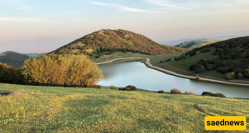
Laton sits west of the town of Londvil (a district of Astara) amidst mountain and pastureland.
Although the waterfall is in a remote mountainous position, roads and villages along the way make access relatively straightforward.
There are two main approaches:
the Soha → Laton route
the Londvil → Laton route
The Londvil route approaches from Gilan; the Soha route comes from Ardabil. “Soha” is the name of a village and a lake — many visitors coming from Ardabil start from there.
These two routes differ from one another.
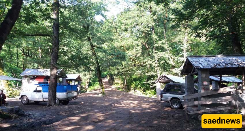
Distance from Londvil to Laton is about 14 kilometres. Roughly half of that route — up to the village of Kote Komeh — is paved; the rest is unpaved dirt road until about 1 km from the waterfall, then a short walk through the forest down to the waterfall.
If you plan to drive with an ordinary car, this route is passable most of the year up to Kote Komeh provided there’s no heavy snow. Beyond that the dirt road is usually possible with a normal car when the ground is dry; after rain the mud and slipperiness make driving difficult. Because the mountain road has steep gradients and no guardrails, driving carefully is recommended.
If you do not want to drive the dirt section, villagers often operate pickup (Nissan-style) shuttles for a fee that will carry you to the end of drivable road. If you own an off-road or 4×4 vehicle, the route is not especially hard.
The short walking section is well trodden and obvious — there are no confusing forks.
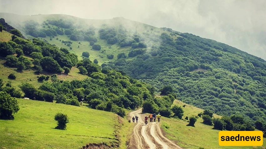
This route is more challenging than the Gilan approach: much of it must be done on foot and there’s no defined road. The trailhead is the village of Soha. From Ardabil or Namin you reach the small town Abibeyglu (Abib-Beygloo), pass three farming villages, and finally arrive at Soha.
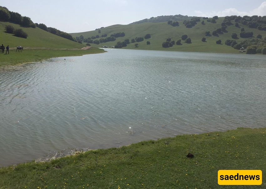
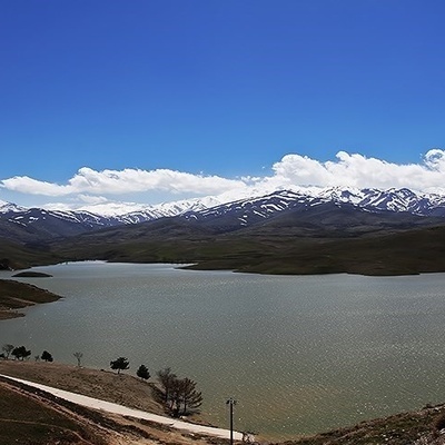
From Soha to the eponymous lake there is a roughly 3-kilometre dirt track that you can use with the help of local drivers.
From Soha to Laton there is no village — only a small mountain cabin/ rest shelter.
Because the Soha → Laton path is not well marked, it’s recommended to travel with organized tour groups or a local guide. Use GPS and preparatory route data (for example from platforms like Wikiloc) before you go. This trail is very beautiful and more adventurous, but it’s not advised for inexperienced hikers.
Most groups who choose Soha begin by visiting Kote Komeh then continue to Londvil, so they often travel without a private car. Mountain bike and MTB groups have traversed both routes several times without major issues.
Both routes can be done as a one-day return trip if you start early in the morning. If you prefer to stay overnight, there are guesthouses in Kote Komeh. Along the way you can buy basic supplies — snacks, bottled water, tea, hot water and simple food.
If you need convincing, the photos of this pristine nature are persuasive — but here are the main reasons:
First and main reason — the waterfall itself.
A waterfall about 105 metres high with always-flowing water. Flow may lessen some months but it never fully stops. In height terms Laton is considered Iran’s highest waterfall.
Second reason — the scenic approaches.
Both the Londvil (Gilan) and Soha (Ardabil) routes are scenic, full of photo opportunities. On a clear day the cascade is visible from about a kilometre away — perfect for photography.
Third — variety along the Soha route.
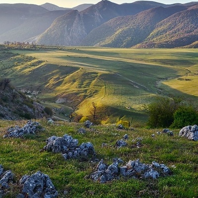
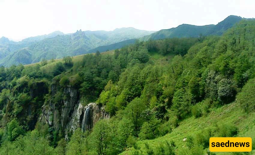
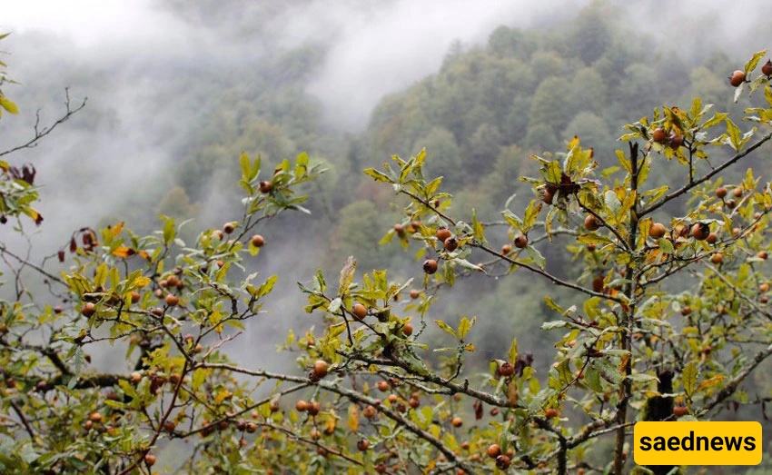
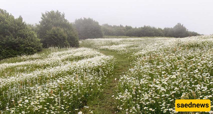
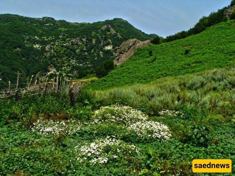
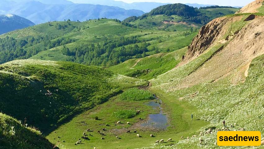
From Soha you encounter a mountain lake and open spaces around it, meadows of chamomile and poppy that bloom after the lake, dense Hirkani (Hyrcanian) forest full of wild plums and sour-apple trees, strawberry bushes, highland pastures where villagers graze livestock, the Spinas summit and the river that feeds the waterfall — a compact summary of the region’s beauty.
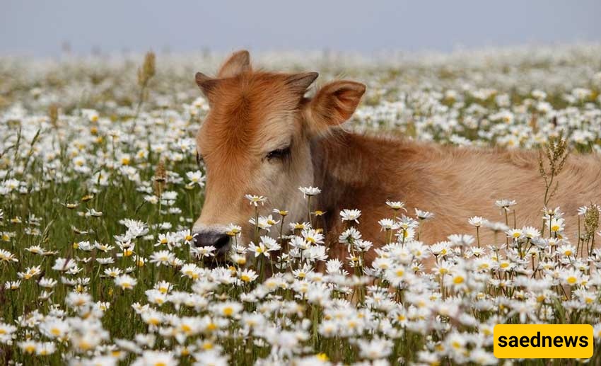
Locals are Talysh and mostly shepherds; visiting gives you a glimpse into simple rural life.
Gilan’s climate is temperate four-season overall, but mountain areas are colder and forested zones are often misty. Summer highs can reach about 35°C on the warmest days; coldest autumn/winter days are near 0°C. Laton’s climate is generally cool and mild most of the year.
Best visiting season: from early spring (Farvardin) through early autumn (Mehr). Summer is lush and flowery but humidity can be uncomfortable.
Laton sits amid emerald forest. Trees around the falls include oak, wild plum, hawthorn, apple, medlar (azgil), maple, walnut, cherry plum (lilaki) and hazelnut. These forests remain vivid for about nine months of the year, making camping and nature visits memorable.
Wildlife present includes hedgehogs, horses, wolves, wild boar, bears and domestic sheep — typical of remote northern woodlands.
The torrent that forms Laton originates on steep Mount Spinas (Spineh/Spinas) at about 2,105 metres elevation. Water flows down from the mountain through three natural pools and three smaller cascades before reaching Laton. After Laton the river — called the Londil River — continues its winding course and ultimately empties into the Caspian Sea.
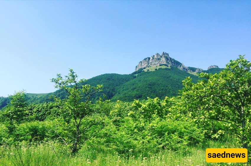
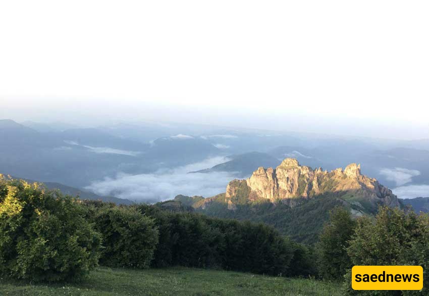
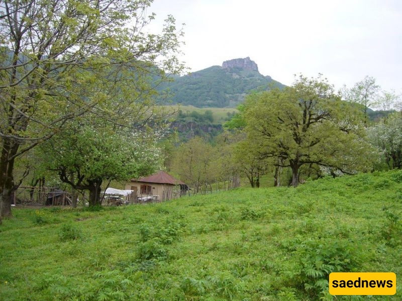
In many photos of Laton the jagged peak of a nearby mountain appears, looking like a fortress on its summit.
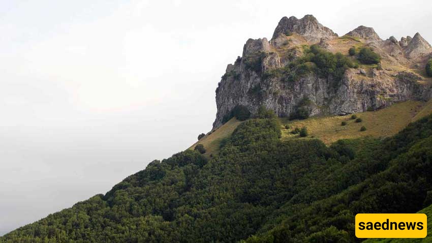
Spinas — at around 2,105 metres — is the highest peak in the Londvil–Astara area. Its rocky summit and vertical cliffs resemble a castle. Local lore suggests there was once a defensive fort up there, but there’s no strong documentary evidence for that claim. Hikers taking the Soha route pass alongside Spinas and enjoy mountain and Hirkani forest views.
Moving toward Ardabil the forest gives way to open highland meadows and grazing pastures. The elevated meadows around Laton host summer pastures for local flocks. Niaraq is a plateau/ pasture area northwest of the waterfall — a lovely place for camping and to watch grazing animals and hear bell sounds in spring and summer.
Kote Komeh is the closest settlement on the Londvil side. It has attractions such as a natural hot spring (a forest hot spring, unique in the country), an old mill called Asieh-Shavan and an ancient cemetery.
Kote Komeh Hot Spring
This unique hot spring, set inside the forest, is found at the beginning of the Laton ascent route. Facilities include showers, a pool, parking, a buffet, toilets and simple guest rooms.
Near Laton are three large natural basins and three smaller ~10-metre falls that make for pleasant visits. Note: The end of the trail between the 105-metre drop and a 65-metre drop contains dangerous cliffs — exercise caution.
On Mount Spinas there’s a ruin often called Laton Castle (also associated with Babak Khorramdin in local stories) — sometimes referred to as “Qal‘eh-e Spineh.” Climbers and high-altitude hikers can visit the site around 2,000 metres.
A same-day return trip to Laton is feasible, but if you need to stay overnight there are some guesthouses and rental rooms in Kote Komeh.
Camping overnight is not recommended because mountain weather in Gilan changes quickly and wild animals (wolves, boars) inhabit the forests. Although animals generally avoid inhabited areas, caution is wise.
Trail cabins (for instance the simple “Amu Yadollah” hut) are minimal — suitable for resting, a quick meal and refilling water bottles, but don’t expect comfort.
There are small unmarked springs along both routes; local hikers know which are potable, but err on the side of caution if you’re unsure.
Laton is not a routine roadside attraction; most visitors base themselves in nearby towns. Astara and Ardabil are the largest nearby cities and each has many sights.
The river that flows from the waterfall reaches the Caspian Sea at the shore near the town of Londvil. Londvil itself is not a major tourist town; its beach is the main local draw.
North of Laton lies the Fandoglu (Fandoghlou) forest (on the Gilan–Ardabil border), a spectacular area with attractions including a cable car.