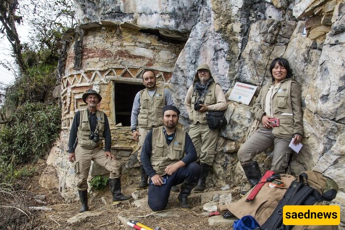
An international team, employing LiDAR scanning and photogrammetry, has mapped over 100 previously unrecorded structures at Gran Pajatén in Peru’s Rio Abiseo National Park, reshaping our understanding of the Chachapoya civilisation’s scale, role and landscape planning.
Archaeologists sometimes spend years in the field before a single discovery rewrites expectations. Recently, a team working in the remote Peruvian Andes reported exactly that kind of breakthrough: they identified more than 100 previously unknown structures tied to the Chachapoya — the so-called “Warriors of the Clouds” who resisted Inca conquest for centuries.
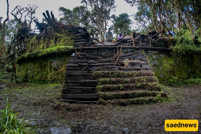
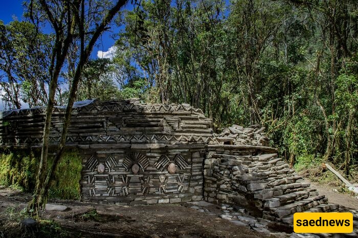
The newly mapped complex belongs to Gran Pajatén, a pre-Columbian settlement in a remote section of the Andes within Río Abiseo National Park (a UNESCO World Heritage Site), roughly 300 miles north of Lima. The Chachapoya thrived in the northeastern Andes between the ninth and sixteenth centuries and defended their territory against Inca expansion far longer than many neighboring groups. Gran Pajatén’s altitude, dense vegetation and isolation helped earn the inhabitants their dramatic nickname.
The Gran Pajatén site was first recorded in the 1960s and, by the 1980s, researchers had documented about 26 structures. The World Monuments Fund (WMF) announced last month that fieldwork since 2022 — aided by advanced remote-sensing methods — has revealed a much larger and more complex urban ensemble than previously known.
“Although specialists suspected that the extension of Gran Pajatén was greater, our findings were unexpected — not only in terms of scale, but in how they reframe the role and significance of the site,” said Juan Pablo de la Puente, executive director of WMF Peru.
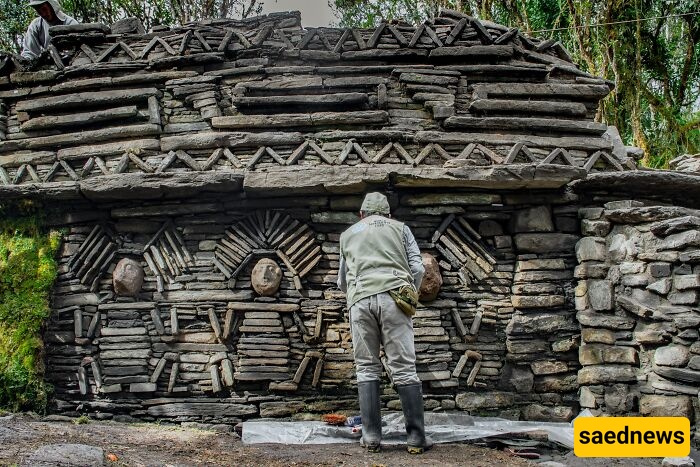
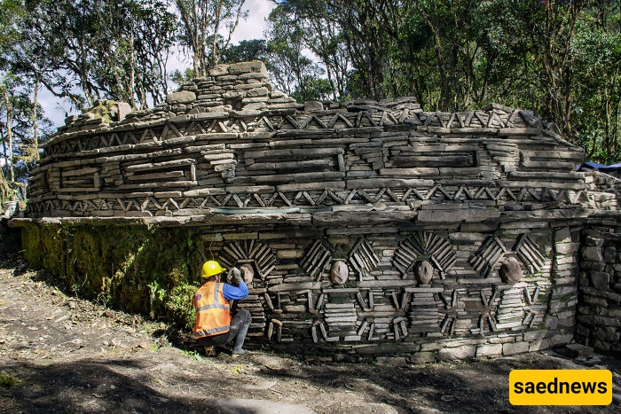
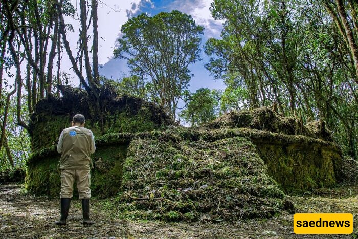
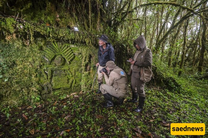
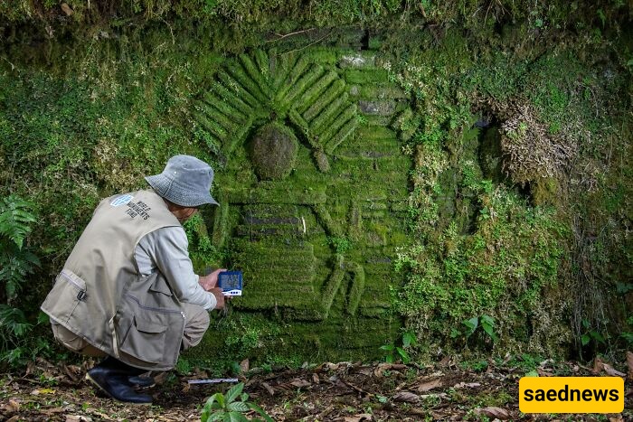
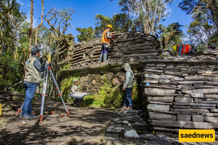
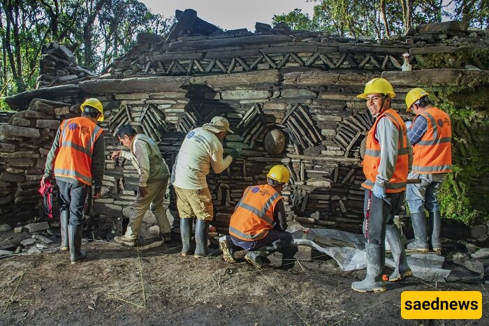
Using LiDAR scanning and photogrammetry to see through the forest canopy, the team uncovered an organized settlement with agricultural terraces, circular buildings and cliffside tombs at elevations approaching 10,000 feet. High-relief friezes and stone mosaics depicting human figures suggest that Gran Pajatén had both ceremonial importance and strategic cultural weight; its prominent placement in the landscape reinforced its symbolic role.
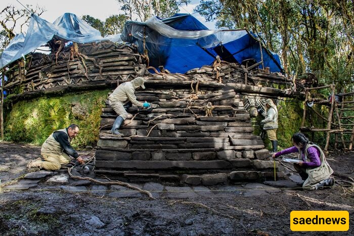
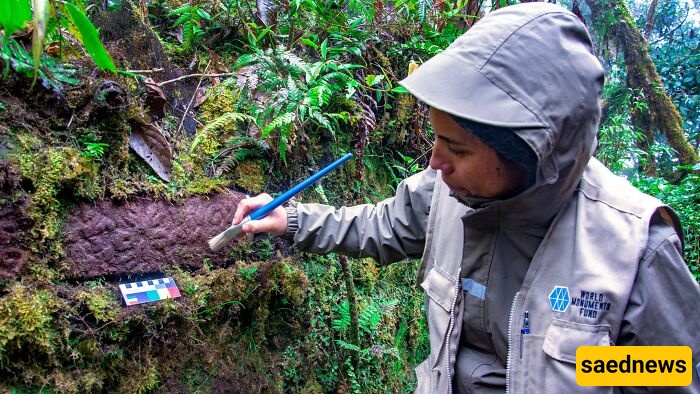
Conservators are working to stabilise the isolated structures while preserving their original layout. At-risk buildings have been treated with a specially formulated clay-based mixture designed to reinforce stone without altering the site’s historic fabric.
Although the team has already mapped hundreds of new structures, they have processed only about 10% of the LiDAR data so far. “What excites me most is that we’re only scratching the surface,” de la Puente said. “The path ahead is full of possibility, and we’re just beginning the journey.”
Gran Pajatén remains inaccessible to most visitors because of its rugged terrain and dense vegetation, but digital mapping and 3D renderings are making the settlement more available to researchers and the public, helping preserve and share this once-hidden chapter of Andean history.