SAEDNEWS: Karefto Cave, located in Kurdistan, Iran, is one of the oldest known human settlements featuring stunning rock carvings and archaeological evidence dating back thousands of years. It offers a unique glimpse into prehistoric life and early human culture in the region.
Karefto Cave is one of the tourist attractions of Divandarreh in Kurdistan Province and is among the national heritage sites of Iran.
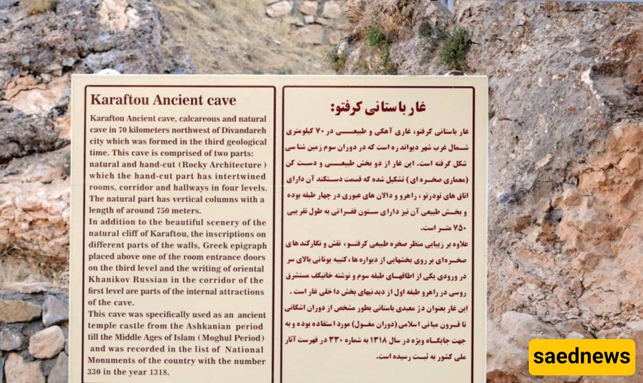
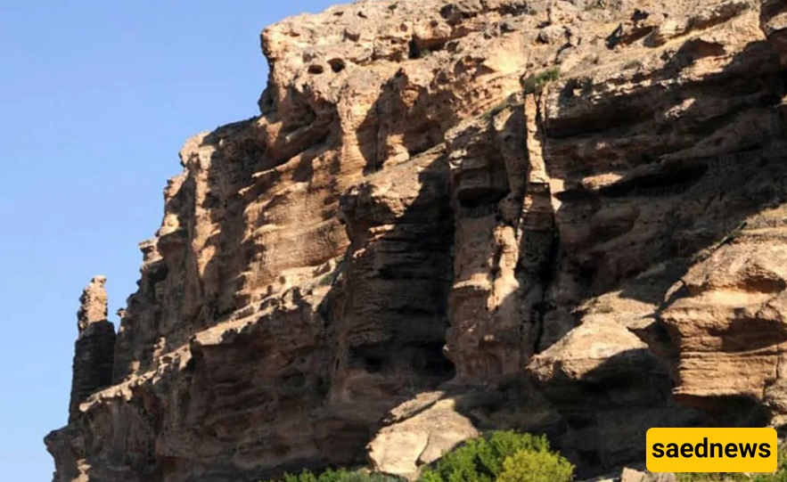
Karefto Cave, one of the sights of Kurdistan Province, is located 67 kilometers from the city of Divandarreh. This limestone and ancient cave was formed during the Mesozoic era and has been inhabited and used by humans during different periods of time. One of the reasons for Karefto Cave’s significance is the presence of a valuable Greek inscription on the third level, based on which this place is attributed to Hercules, one of the gods of ancient Greece. Karefto Cave was registered on the country’s national heritage list in 1939.
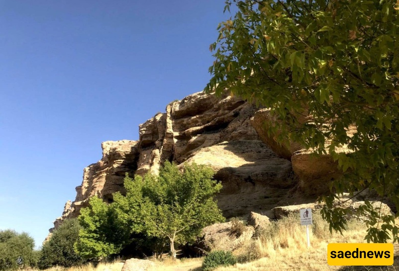
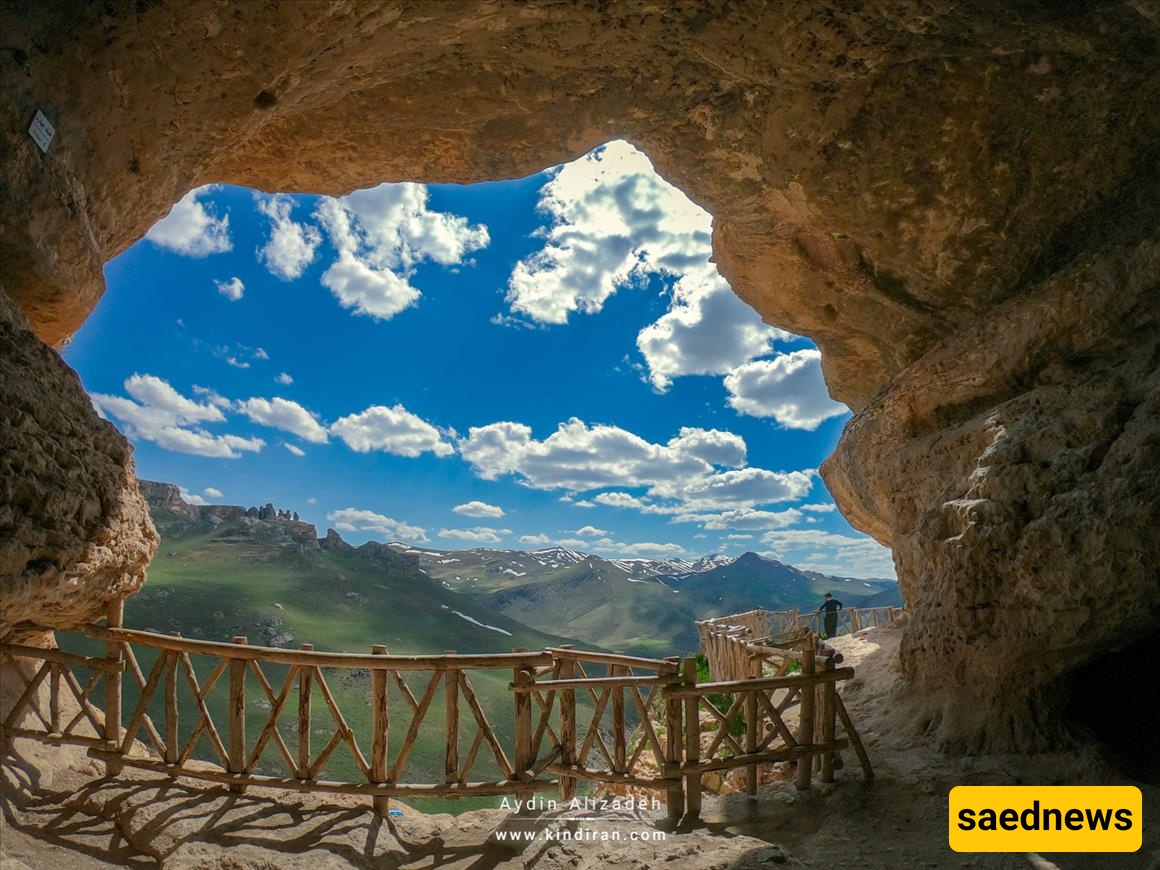
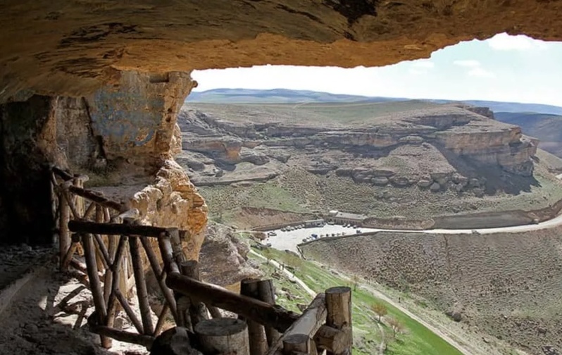
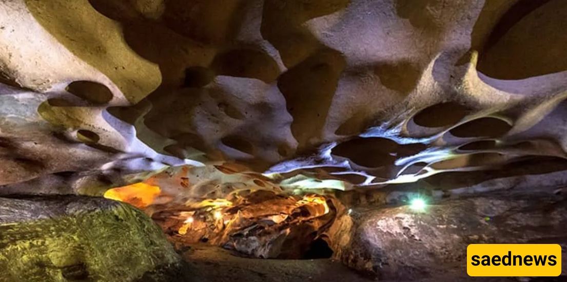
Karefto Cave is one of Iran’s mysterious and astonishing caves and is considered one of the largest ancient caves in the country. This cave is located in Kurdistan Province, within a limestone mountain range in the north of a deep and beautiful valley. Around it, many shelters, crypts, and cavities can be seen. In winters and cold weather, the inside of the cave is warm, and during summer, due to air drafts, the cave’s interior remains cool.
Karefto limestone cave was formed during the Tertiary geological period and emerged from water. Even now, some parts inside Karefto Cave contain water, and to visit some sections, small boats must be used.
Karefto Cave was used by humans during various periods from prehistoric times to the Islamic era. It features rock-cut and hand-carved architecture, and many cultural remains have been found there. Besides human habitation, the cave is also home to animals such as bats, rock pigeons, and swallows.
There are different opinions about the name Karefto Cave. It is said that Karefto is probably a combination of two words: “Karf” and “To.” The word “Karf” or “Kraft” in the Pahlavi language means “reward,” and in the Avesta language means “praise.” The word “To” in ancient languages such as Sumerian and Elamite means “sun” and “heat.” In modern Kurdish, the word “Taw” means heat and “Hetaw” means sun. Therefore, if this combination is correct, Karefto means “Sanctuary of the Sun,” and it is likely that this cave and fortress was one of the Mithraic temples in Kurdistan.
In the past, Karefto Cave served as a refuge and shelter for people during attacks by various tribes, and for this reason, among the local people of the region, it is known as “Karefto Fortress Cave” or “Qelay Ke Raftu” (the fortress that was taken).
Some also believe that the word Karefto was originally “Gerefto,” which in Kurdish means “taken” or “conquered.” Although the cave was damaged during a period due to raids and invasions and was conquered after a bloody war, many doubt that the name of the place originated from this conquest and victory.
Karfto Cave is one of the tourist attractions of Divandarreh in Kurdistan Province, located about 67 kilometers northwest of this city and 70 kilometers east of Saqqez. The cave is situated among the villages of Masoudabad or Torkan Bolagh (south), Mirsaeed village of Saqqez (west), Aliabad and Nokhod Dareh of Takab (north), and Yuzbashkandi village (east and southeast).
To visit Karfto Cave, travel to Divandarreh County. From Divandarreh, head toward Saqqez. After traveling 23 kilometers on the main road, at the Takab crossroads, turn right onto a secondary road. Continue on this route for another 35 kilometers toward Takab. Then, turn left onto the road leading to Karfto Cave, and after about four kilometers, you will reach the cave.
Distance from Sanandaj to Karfto Cave: 163 kilometers
Distance from Takab to Karfto Cave: about 35 kilometers
Address of Karfto Cave: Kurdistan Province, about 67 kilometers northwest of Divandarreh
The Karfto limestone cave was underwater until the Mesozoic era of the Third Geological Period and emerged from the water toward the end of this period. Inside the cave, a Greek inscription was found, indicating that Karfto was probably inhabited for a time by the Seleucids, who were moving westward following the conquests of Mithradates II of the Parthian Empire. Initially, the age and history of habitation or use of this cave were attributed to the Seleucid, Parthian, and Islamic periods based on this inscription and the existing architecture. However, after scientific and archaeological research in the cave and surrounding sites, it became clear that Karfto, like other caves and shelters in the region such as Kani Mikail Cave, had been in use since the late 5th millennium BC.
Over time, Karfto Cave has attracted the attention of many Orientalists and researchers, including Demorgan, Rawlinson, Ker Porter, Khanikov, and Von Gall, who visited the cave and produced maps of it. Sir Robert Ker Porter visited Karfto in 1818 and read the Greek inscription on its third floor. In 1838, Henry Rawlinson visited the cave and corrected Ker Porter's translation of the inscription.
In 1917, Khanikov, a Russian Orientalist, visited Karfto Cave and left a written note in the corridor connecting the first and second floors, which still remains. In the early 1960s, Sir Aurel Stein and his assistant Henry Ayub Khan prepared maps of the carved rooms, corridors, and natural galleries. Since the corridors and galleries have not yet been fully excavated and cleared, Stein’s map is incomplete.
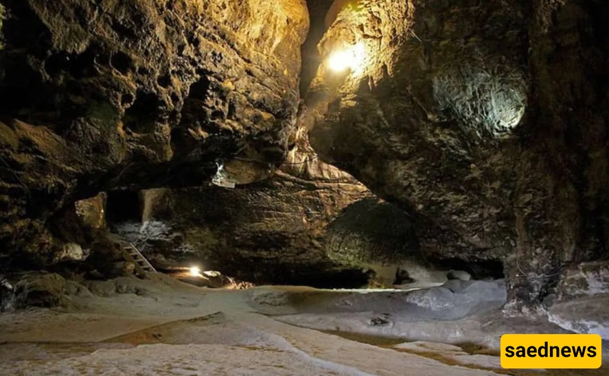
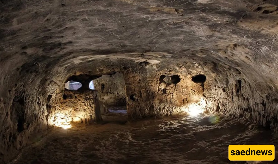
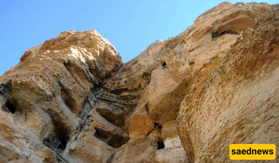
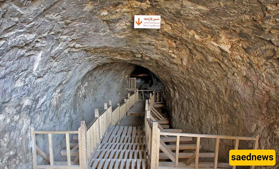
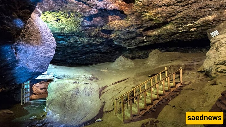
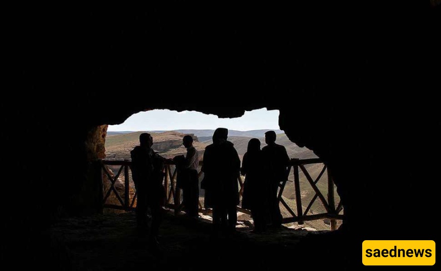
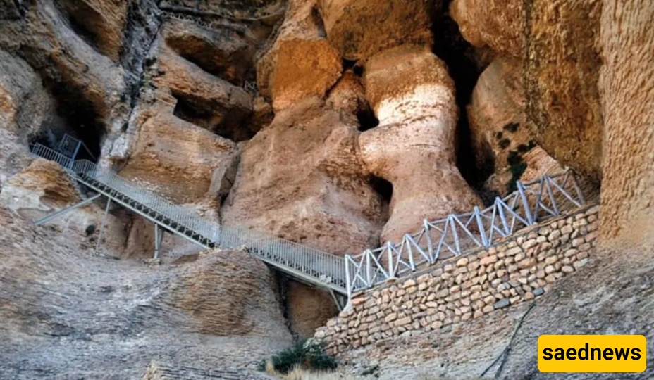
The entrance to Karfto Cave is located 20 to 25 meters above the mountain slope. In the past, there was no staircase to access it, but now, with the help of 180 steps, visitors can easily climb up. The main path of the cave is about 750 meters long, with ceiling heights ranging from one to 12 meters. The cave contains large halls with high ceilings, winding paths, corridors, and multiple openings connected to each other. So far, no one has been able to identify all these paths or prepare a complete map of the cave. Due to collapses over time around the entrance and in the rock architecture, the number of rooms and corridors on all floors is not clearly distinguishable.
In front of Karfto Cave, there are four levels of beautiful rock-cut architecture. Each floor has interconnected rooms and windows that open to the outside of the cave. The fourth floor offers the best view of the opposite mountain, which locals say resembles three girls and a tailor man. The most exquisite architecture is on the third floor, where the carving and shaping of the rooms are carefully done, and the ceilings are arched. Furthermore, the doorways, threshold stairs, windows, and light openings of the rooms have special decorative significance. Remains of a chimney with stone steps can also be seen on this floor, which provided access to an underground water channel. Much of this chimney is now destroyed, and only rubble remains.
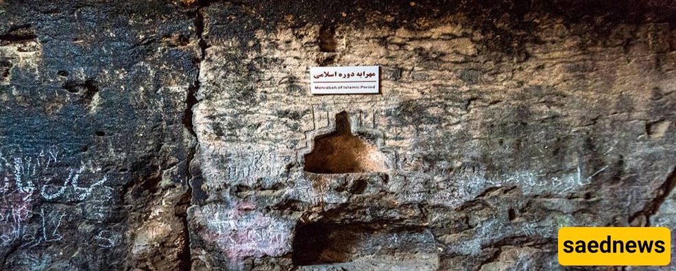
Above the entrance of one of the third-floor rooms, there is a Greek inscription. Based on this, some believe the cave was a temple of Heracles (Hercules), while others think the cave was temporarily inhabited by the Seleucids. The inscription translates as follows:
"This is the house of Heracles; whoever enters it is safe. Where Heracles dwells, let no impurity enter."
On the walls of some rooms and corridors on various floors of Karfto Cave, abstract carvings of animals, humans, and plants have been made. These include depictions of deer, horses with riders, and unknown animals. Among these, the deer motifs on the second floor are the oldest.